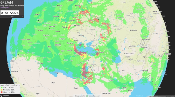
If you are working on IoT device with GPS, this is a nice site for you.
GPSJAM: where you can see GPS Jamming.
See the Map: ![]()
You can also see a lot of information about this site in its FAQ.
- What exactly does this map show?
- Where does this data come from?
- Is it just GPS? What about GLONASS, BeiDou, etc.?
- Does red and yellow always mean there’s jamming?
- What can cause an aircraft to report low navigation accuracy?
- The site is called “GPSJAM” but it might not be GPS or jamming?
- What are the conflict zones where GPS jamming is regularly observed?
- What time zone are the dates in?
- When is the site updated with new data?
- I live in one of the red zones and my GPS was fine?
- Why aren’t there red or green hexes on some parts of the map?
- What’s that cool background image on some pages?
- How is the percentage of bad aircraft calculated?
- Is the data complete?
